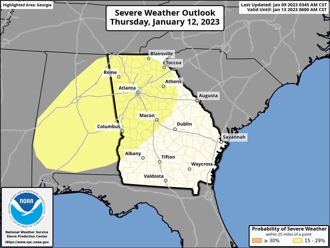
A strong to severe line of storms associated with a strong cold front is expected to impact north and central Georgia Thursday afternoon into Thursday evening.
Main Points
- Models are trending towards a severe weather event, however, this event is still several days away and the forecast is subject to change.
- At this time, a line of storms is expected to move through Thursday afternoon into evening which has led the Storm Prediction Center (SPC) outlining portions of the area in a 15% risk for Day 4 (Thursday).
- A 15% Risk would translate to a Slight Risk (2 on a scale of 0-5) if the forecast stays on track.
- Timing and impacts are subject to change as the forecast evolves.
- Confidence is increasing that north and central Georgia will see impacts related to the line of storms. The primary impacts expected are:
- Damaging wind gusts (up to 60 mph)
- potential to bring down trees and powerlines.
- A few, isolated tornadoes
- Frequent lightning
- Locally heavy rainfall
- potential to lead to localized flooding in low-lying areas or areas with poor drainage \