After a few spring like days, winter reminds us… it is still winter.
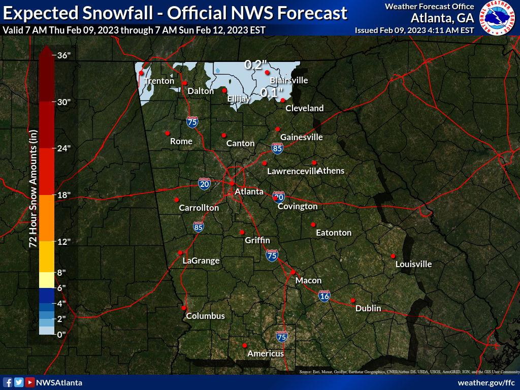
An Upper Low Pressure system moving across the state Late Saturday into Early Sunday will create the chance for Snow…
*Much uncertainty exists as numerous factors are in play for this snow potential
A cold core upper low will be moving ENE along the Gulf Coast Saturday and into GA by Saturday night. Wrap-around moisture on the north side of this upper low will bring the potential for snow, rain/snow mix or a cold rain along and to the north of its track.
You can visit the Winter Weather Page for updates to our snow forecast and snow potential graphics here: Winter Weather
What there is confidence about as of now:
- Timing: The best potential appears to be Midnight – 8 AM Sunday.
- It will either be a very cold rain, rain/snow mix, or a wet snow (no freezing rain or sleet based on the forecast temperature profiles).
- Surface temperatures will be generally above freezing and into the mid 30s. (except in the mountains where accumulations are more likely) with highs on Sunday in the upper 40s to near 50.
- The North GA mountains have the best chance of accumulations.
Where there is the least amount of confidence:
- Location: Depending on the track of the upper low, areas north of the low would have the best chance of winter precip. Some models track the low further south, thus introducing snow or rain/snow (with surface temps above freezing) into the I20 corridor and even possibly further south.
- The lowest 1500 feet temperatures: We are confident that precip will start as snow in the clouds and fall into the lowest 1000-1500 feet near the surface which should be above freezing. Models disagree on the depth of that warm layer and just how warm it actually is.. warmer = rain, a deeper layer above freezing = rain, a shallower or colder layer = rain/snow or all snow.
Related Topics

Click to comment

Bulloch Public Safety
05/11/2026 Booking Report for Bulloch County

Chattooga Local News
Gov. Kemp Signs Legislation Strengthening Georgia’s Workforce

Chattooga Opinions
The Joy of the Journey: After

Bulloch Public Safety
GDOT: Traffic Impacts for the I-16 at I-95 Improvement Projects Through May 16

Bulloch Public Safety
SE Ga Road Work: Weekly Traffic Interruption Advisory Through May 15

Bulloch Public Safety
04/20/2026 Booking Report for Bulloch County

Bulloch Public Safety
04/27/2026 Booking Report for Bulloch County

Bulloch Public Safety
05/04/2026 Booking Report for Bulloch County

Bulloch Public Safety
04/13/2026 Booking Report for Bulloch County

Bulloch Public Safety
05/01/2026 Booking Report for Bulloch County


